 ar
ar bg
bg hr
hr cs
cs da
da nl
nl fi
fi fr
fr de
de el
el hi
hi it
it ko
ko no
no pl
pl pt
pt ro
ro ru
ru es
es sv
sv tl
tl iw
iw id
id lv
lv lt
lt sr
sr sk
sk sl
sl uk
uk vi
vi et
et hu
hu th
th tr
tr fa
fa ms
ms hy
hy ka
ka ur
ur bn
bn mn
mn ta
ta kk
kk uz
uz ku
ku
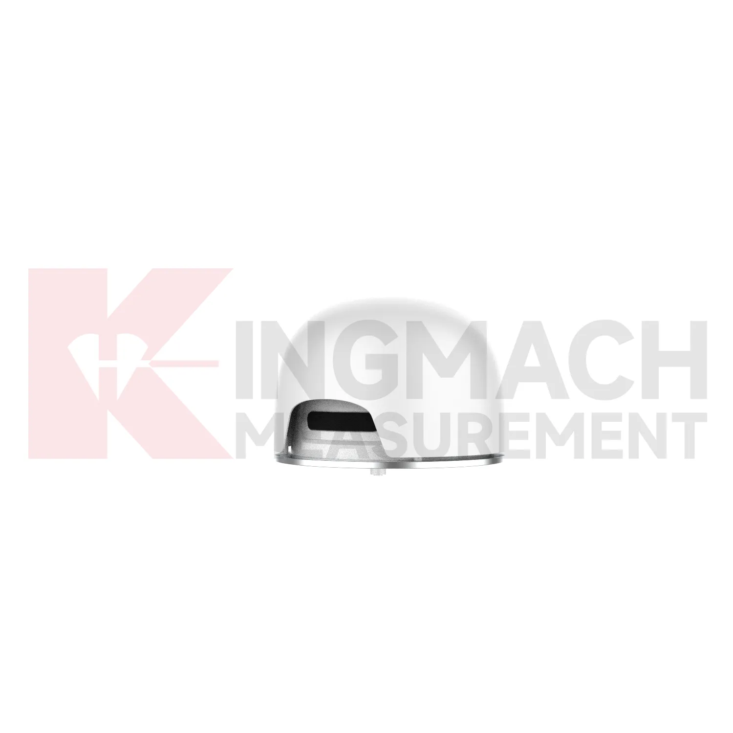
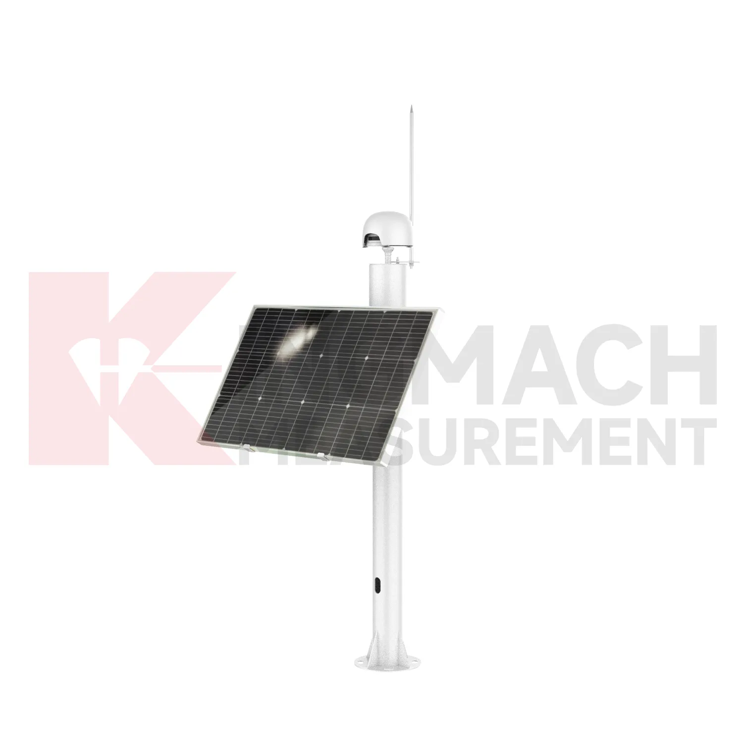
Integrated GNSS
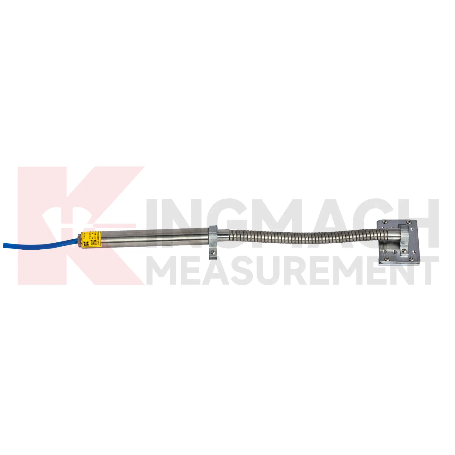
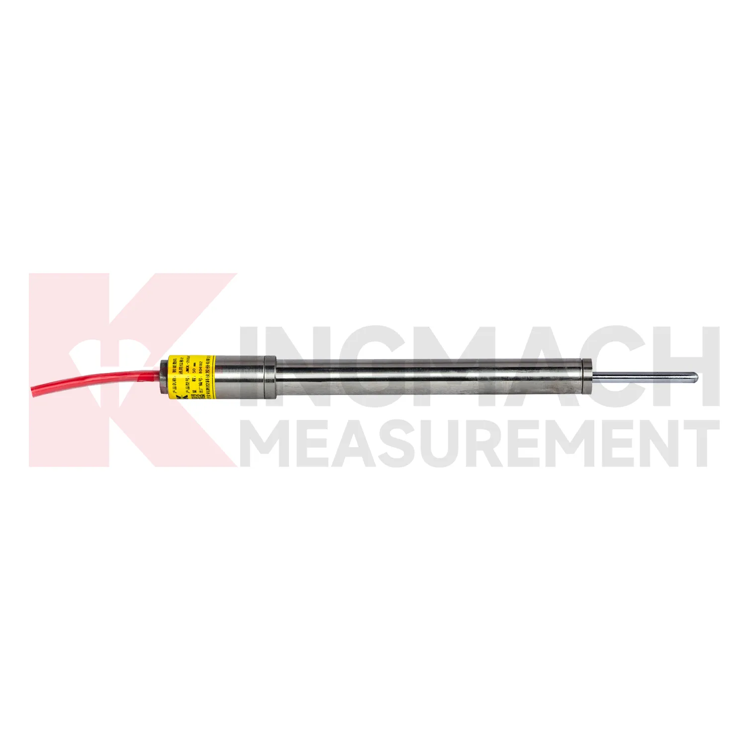
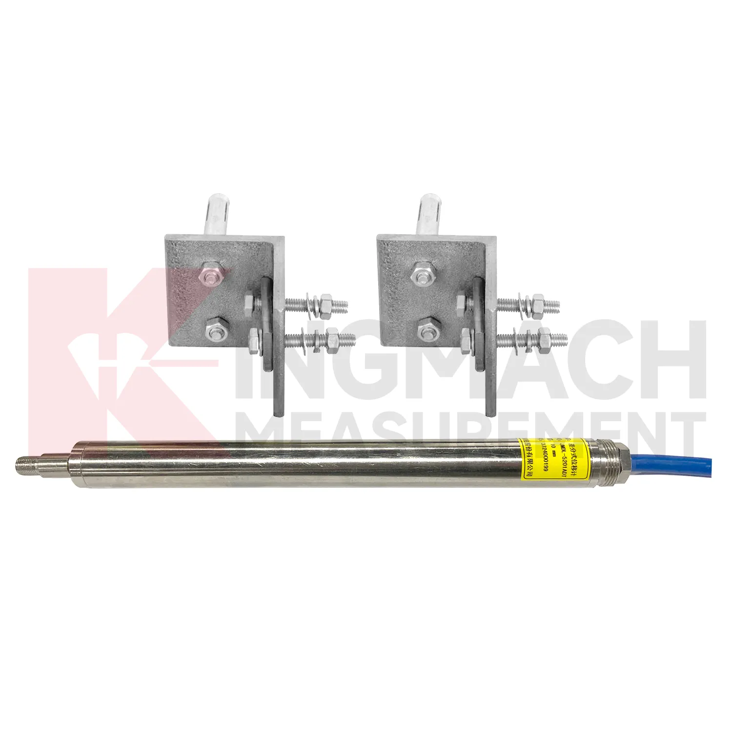
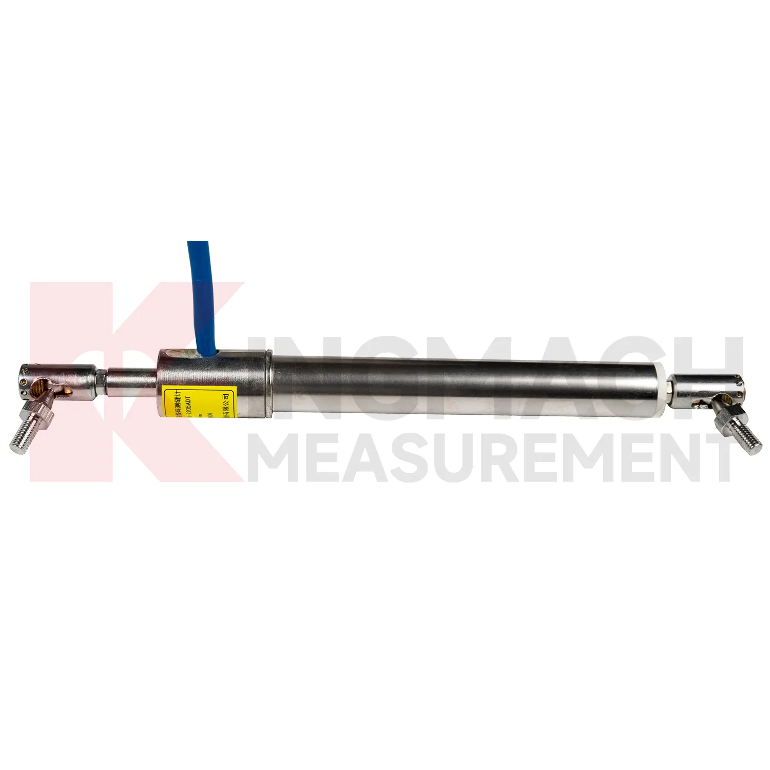
For reinforced soil and geogrid work, Kingmach Integrated GNSS include the JMDL-24XXAT Smart Flexible Displacement Meter. This product is built around patented inductive flux frequency modulation technology and is designed for deformation or strain monitoring in geogrid materials used in reinforced soil and pile-net subgrade foundations. The measuring rod extension is flexible, so it can deform with the geogrid while both ends are clamped by mounting brackets for reliable strain transfer. Listed ranges are 30 mm and 50 mm, with 0.01 mm sensitivity and 0.5%FS accuracy. The non-contact measurement layout keeps the measuring rod and internal coil independent, reducing damage risk during installation and service. A 20-point curve fitting process supports nonlinear correction and accurate displacement output. Kingmach lists a designed service life of up to 30 years for this product, which fits long-term railway, roadbed, slope, and foundation monitoring where buried materials cannot be visually inspected after construction. For this model, the installation record should focus on geogrid layer position, bracket clamping force, fill sequence, compaction stage, cable exit route, and the first stable value after backfilling. Those details are different from crack monitoring because the sensor is working with buried reinforcement deformation rather than an exposed joint. During later review, the curve should be checked with settlement, traffic loading, rainfall, and earthwork records so engineers can understand how the reinforced soil body is behaving.
Application of Integrated GNSS
In railway and highway subgrade monitoring, Integrated GNSS are used to observe geogrid deformation, embankment movement, track foundation displacement, culvert joint movement, and settlement-related structural shifts. The field problem is that deformation may occur inside reinforced soil or pile-net foundations where visual inspection cannot reach after backfilling. Kingmach JMDL-24XXAT flexible displacement meters are designed for geogrid materials in reinforced soil and pile-net subgrade foundations. The bendable measuring rod can deform with the geogrid, while both ends are clamped using mounting brackets. Listed ranges are 30 mm and 50 mm, with 0.01 mm sensitivity, 0.5%FS accuracy, 20-point curve fitting, and a designed service life up to 30 years. For larger movement, JMLS-22XXADT wire rope sensors and JMDL-49XXAT formwork or steel wire meters can support long-distance displacement monitoring. These readings help maintenance teams connect settlement, traffic load, rainfall, and construction records. During operation, the monitoring team should keep the baseline, temperature, inspection notes, and nearby sensor behavior in the same review file. This makes it easier to tell whether a movement trend comes from normal service, a repair event, changing load, water influence, or developing structural risk. Clear records also help owners decide when a field inspection is needed instead of waiting for visible damage.
The future of Integrated GNSS
The future of Integrated GNSS will include more mixed measurement packages rather than single-sensor orders. A slope package may combine GNSS, multipoint displacement, crack gauges, pore pressure, rainfall, and tilt. A bridge package may combine differential displacement, strain gauges, load cells, accelerometers, temperature, and bearing inspection records. A tunnel package may combine multipoint displacement, convergence, lining strain, water pressure, and vibration. Kingmach already provides a broad product ecosystem across displacement, strain, load, settlement, tilt, environmental monitoring, acquisition equipment, cables, and software. The next step is project-specific packaging where the displacement instrument is selected together with its data logger, cable, cabinet, communication route, warning logic, and maintenance plan. That approach reduces mismatched hardware and makes the monitoring system easier to operate after handover. It also helps procurement teams compare complete monitoring functions instead of comparing sensor names alone. For complex infrastructure, the package should define which movement point answers which engineering question before hardware is ordered.
Care & Maintenance of Integrated GNSS
For automated Integrated GNSS, maintenance must include the whole data chain. A sensor can be accurate while the monitoring record is wrong because of channel swaps, wrong units, missed zero values, loose terminals, damaged power supply, or unstable communication. Kingmach displacement products may connect to comprehensive testers, bus modules, automatic acquisition systems, RS485 networks, and monitoring platforms. During commissioning, verify each channel by moving the sensor slightly or checking a known displacement point, then record direction, units, baseline, range, and warning values. During service, check whether data gaps match power failures, communication faults, storms, or cabinet maintenance. Keep spare connectors and labels for field work. When replacing a sensor, do not simply reuse the old zero value; record the replacement time, new model, serial number, range, calibration coefficient, and first stable reading. Keep the installation photo, point number, zero value, and expected movement direction with the commissioning record for later review. If a reading changes after maintenance work, inspect the base, anchor, cable, and cabinet before assuming the structure itself has moved.
Kingmach Integrated GNSS
Integrated GNSS are used when a structure needs movement data that can be reviewed, compared, and acted on before deformation becomes visible. Kingmach covers short range crack movement, expansion joint travel, rock layer displacement, geogrid deformation, draw-wire movement, and long stroke position tracking. The category includes JMDL-21XXAT general-purpose displacement meters, JMDL-22XXAT crack gauges, JMDL-24XXAT flexible meters, JMDL-31XXAT multipoint meters, JMDL-32XXAT bedrock meters, JMDL-49XXAT formwork meters, JMDL-52XXADT differential meters, JMCW-21XXADT magnetostrictive meters, and JMLS-22XXADT wire rope sensors. On site, this means one product group can cover bridge joints, tunnel portals, slope movement, dam deformation, railway subgrade settlement, and industrial linear motion. The value is not only the displayed millimeter reading. It is the ability to connect movement, time, temperature, construction activity, and warning limits into one record. The point should be named on the drawing, linked with its cable route, and checked against the expected movement direction before the first automatic reading is accepted. For daily review, the reading should be compared with nearby points, recent weather, site operations, and any loading event that could explain the movement.
FAQ
Q: Which Integrated GNSS are used for rock layers or bedrock?
A: JMDL-31XXAT multipoint meters are used for different surrounding rock layers, while JMDL-32XXAT single-point bedrock meters are used for tunnel rock mass, dam bedrock, slope, or foundation pit movement.
Q: How many points can the multipoint meter support?
A: The multipoint installation kit supports three to five monitoring points, with anchor heads fixed at different depths by drilling and grouting.
Q: What ranges are listed for these models?
A: Both JMDL-31XXAT and JMDL-32XXAT list 50 mm, 100 mm, and 200 mm models with 0.01 mm resolution.
Q: Why monitor several depths?
A: Different layers may move differently. Separating shallow and deep movement helps engineers judge whether the problem is surface creep, deeper rock slip, or overall mass movement.
Q: What records should be kept?
A: Keep drilling depth, anchor location, grouting date, channel name, zero value, cable route, and first stable reading.
Reviews
James Thompson
The tiltmeters and accelerometers are very sensitive and provide precise data. Perfect for our structural health monitoring system.
Ryan Lewis
Fast delivery and excellent product quality. The accelerometers and tiltmeters are highly reliable. Strongly recommend this company.
Latest Inquiries
To protect the privacy of our buyers, only public service email domains like Gmail, Yahoo, and MSN will be displayed. Additionally, only a limited portion of the inquiry content will be shown.
Isabella***@gmail.comGermany
Hello, we are evaluating weir flow meters for a water management project. Please share accuracy deta...
Charlotte***@gmail.comUnited Arab Emirates
Hi, we require instrumentation cables suitable for harsh environments. Could you advise on specifica...
Related product categories
- displacement sensor
- laser displacement sensor
- displacement sensors
- linear displacement sensor
- optical displacement sensor
- wireless displacement sensor
- laser displacement sensors
- non contact displacement sensor
- cable displacement sensor
- draw wire displacement sensor
- inductive displacement sensor
- lvdt displacement sensor